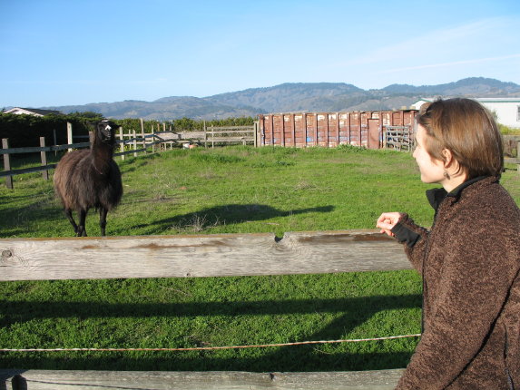
On the drive up, we stopped in Half Moon Bay to visit a llama. The llama was very placid. I think she is accustomed to being ogled by passers-by.
The MLK long weekend was a perfect opportunity to get out of town, so Jeremy and I headed up to Point Reyes National Seashore. We spent most of Saturday wending our way up Highway 1 starting at San Gregorio, and arrived in Olema at dusk. We spent a comfortable night and morning at the bed & breakfast "An English Oak," and then headed off for an all-day hike at the southern end of Pt. Reyes. Here is a photo-journal of our trip. (Well, only the hiking part of our trip, because I like taking pictures of cliffs and lakes and mushrooms and things like that.)
Pictures are already full-size, but you can click on a picture to see it separately.
| |
| On the drive up, we stopped in Half Moon Bay to visit a llama. The llama was very placid. I think she is accustomed to being ogled by passers-by.
|
 |
|
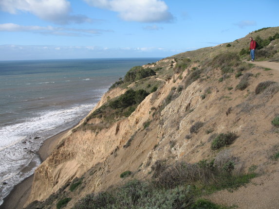
We began our hike at the Palomarin trailhead, and hiked up the Coast Trail. You can see why it is called the Coast Trail. Here is a very small Jeremy on top of some very large cliffs.
|
 |
|
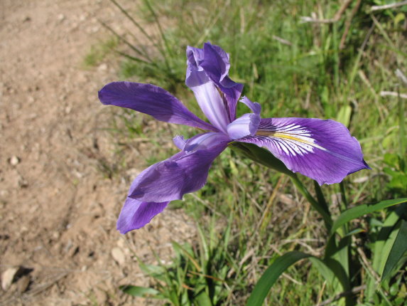
It was a little early for wildflowers, but we did see a few. Here is an iris of some variety.
|
 |
|
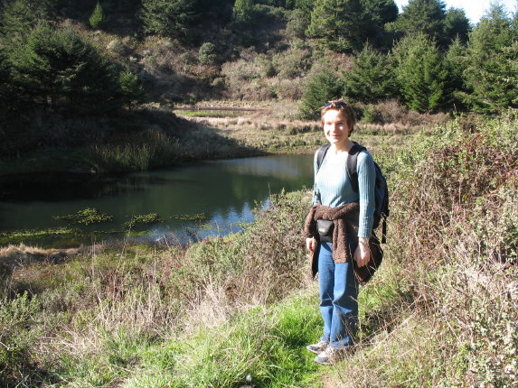
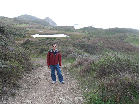
I am admiring a small pond that (according to our guidebook) was formed when a landslide blocked the path of a creek. This was the first of many interesting bodies of water we encountered.
|
 |
|
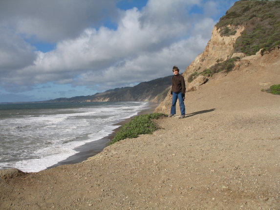
This is the view from beginning of the trail to Alamere Falls. "Warning! Unmaintained trail! Dangerous conditions!" said the sign. But you can't stop people from going to see an awesome waterfall.
|
 |
|
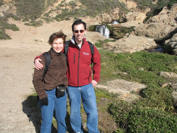
Jeremy and me at Alamere Falls. "Wait a minute," you might say. "I don't see anything awesome about that waterfall." However, this is the view looking upstream. If you look downstream, this is what you see...
|
 |
|
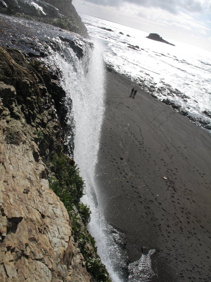
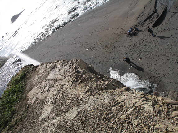
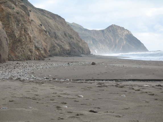
...a waterfall going off a cliff! Onto the beach!
|
 |
|
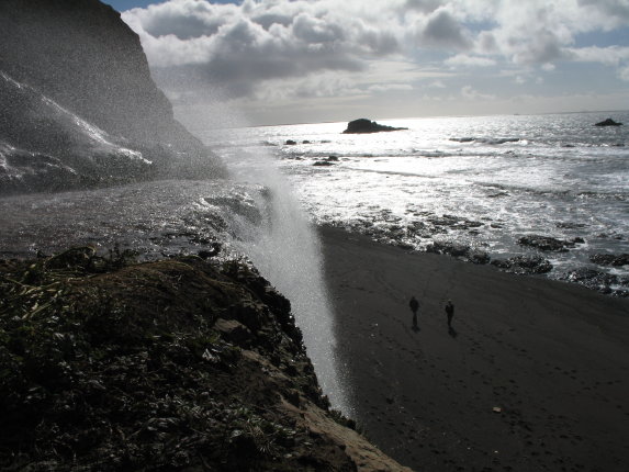
It is very windy at the edge of the cliff, and spray from the waterfall is blowing back upon us.
|
 |
|
The people looking up from the beach seem to think this is all pretty neat, too. Unfortunately, there is no way for us to get down to the beach, unless we jump off the cliff. We have to hike several miles further north to find a safe trail down to the beach.
|
 |
|
This is quite a deceptive picture. It looks as though I am standing at the water's edge. However, the surf is several hundred feet below me (I am on the edge of a cliff that just happens to be lined up with the edge of the waves).
|
 |
|
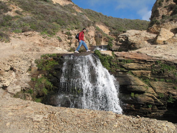
Jeremy walking on a waterfall. Goodbye, Alamere Falls!
|
 |
|
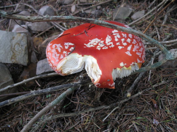
We continue north on the Coast Trail, which takes us through spruce and fir forest with many interesting fungi emerging from the leaf litter. Here is a toadstool that appears to have several bites taken out of it.
|
 |
| This part of the trail was very steep, but it offered great views of a tule marsh (called "Ocean Lake" on our map), with Double Point in the distance. We saw a herd of five deer resting in the grass far below us, but the distance was too great for us to discern which species they were. (They could've been mule deer, fallow deer, or axis deer.)
|
 |
|
We've finally arrived at Wildcat Camp, which has a path down to the beach. If you look very closely, you can see Alamere Falls cascading over the cliff. It is now about two miles south of us.
|
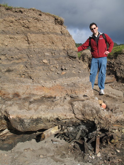 |
| We encountered some strange stratigraphy on the path down to the beach at Wildcat Camp. There were alternating layers of sediment several meters deep (use Jeremy as scale bar - he is 179 cm), but then underneath all that was a layer of branches and logs, some of which appeared to have been machine-cut. How on earth did that happen? Did three meters of sediment accumulate in less than a century? We didn't have a good explanation. Besides, it was time for lunch.
|
 |
| We're now heading back south again. Wildcat Lake was the fourth, and last, of the sizeable lakes we encountered on our trip. We saw a great blue heron fly across the lake and land in a tree at the water's edge.
|
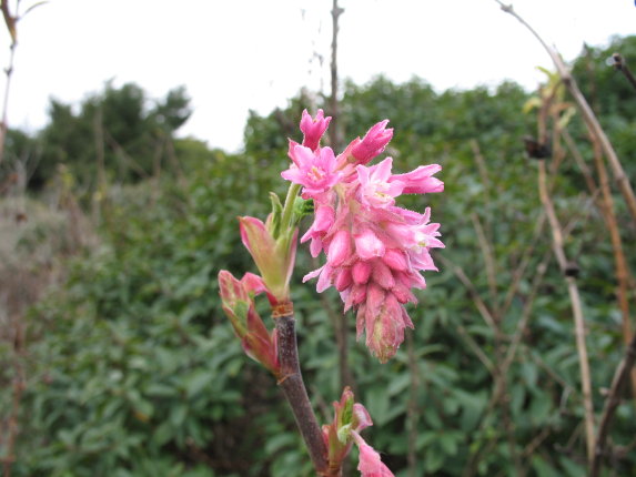 |
| Look! It is a wild currant (Ribes sanguineum). Not to be confused with a wild current.
|
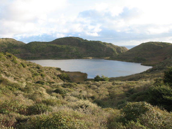 |
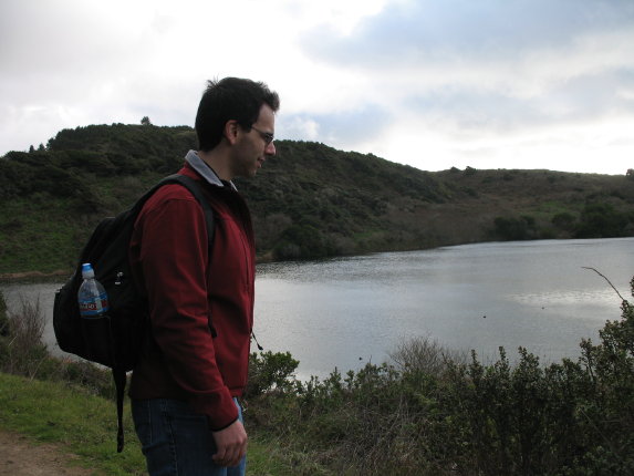
| Pelican Lake, which we passed earlier in the day on our way north, looks even lovelier in the late afternoon sun.
|
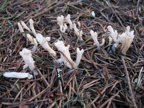 |
| Either this is a herd of very small reindeer hiding under the fir needles, or it is something from the fungal kingdom.
|
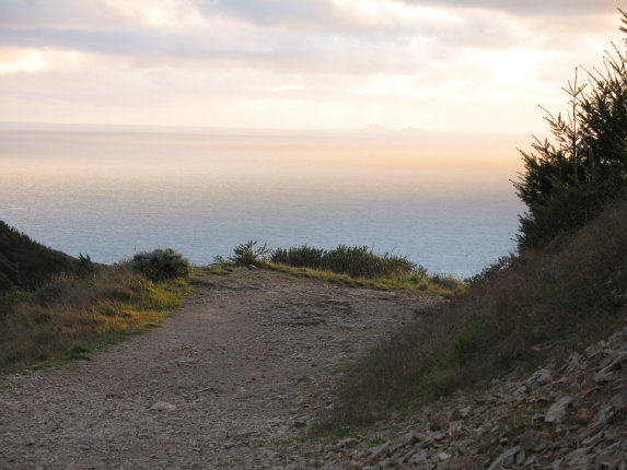 |
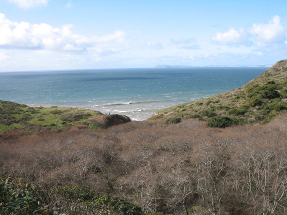
| The sun is sinking into the mighty Pacific. You can see the Farallon Islands on the horizon.
|
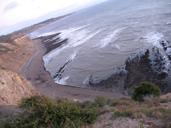 |
| The tide is lower now than it was on our way up, so we can see long spits of black rock sticking out into the ocean. The geology of this place must be fascinating - I wish I knew more about it.
|
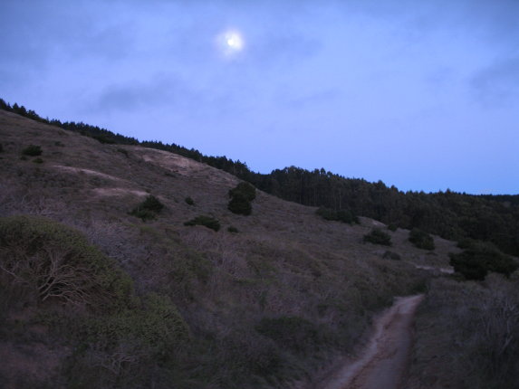 |
| We completed the last leg of our hike by a combination of fading sunlight and rising moonlight. What a wonderful twelve miles it was!
|
| |
|
Last updated January 31, 2008.