  |
Geography, Geology, and Geomorphology of New York |
 |
|
Geographical Context of the Burial Grounds |
|
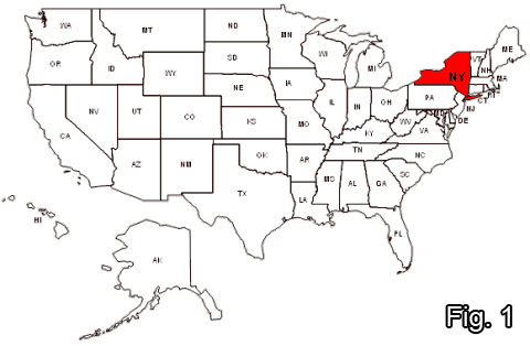
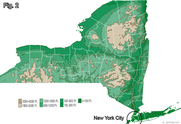
The Archaeological site that we are looking at today, the African Burial Grounds, are found in New York, New York (Fig. 01). Looking at Figure 02 we can see that New York City is located on the south eastern side of New York, bordering the Atlantic Ocean. Because it is a coastal city, it is only about 0-150 ft above sea level (Fig. 02). |
 |
|
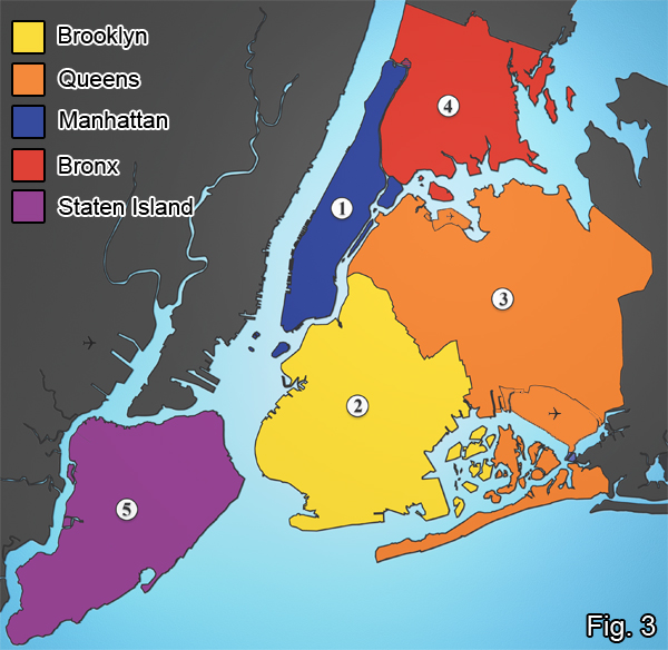
Within this city of New York there are different sections called boroughs, which many of you may know already. In figure 3 we can see the different boroughs labeled by color. |
 |
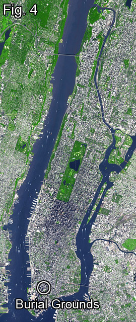 |
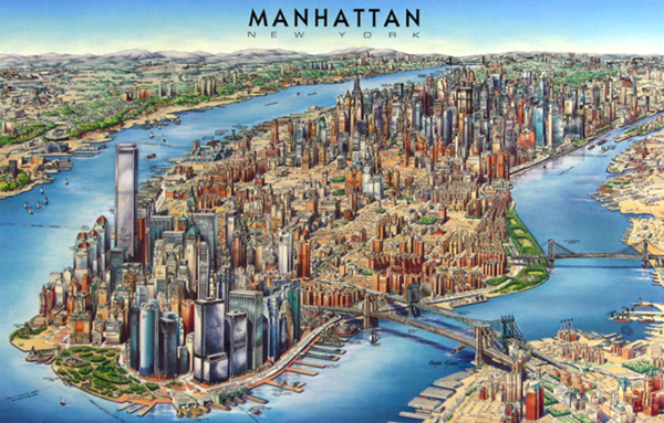
For today we will be looking at Manhattan because this is where the African Burial Grounds are located (see Fig. 04).
Manhattan Island is 22.7 square miles in area, 13.4 miles long and 2.3 miles wide, at its widest. It is mainly known for its city life and landmarks (Empire State Building, World Trade Center, etc.).
Now that we know a little bit about where these burial grounds are located lets take a look at whats beneath the surface. |
Geology of New York |
| Beneath the state of New York, and more specifically Manhattan lies a layer labeled as bedrock. But what exactly is bedrock? According to "Overview of New York Geology "bedrock is "solid rock, tens of kilometers thick, made up of individual rock bodies that vary in size, shape, orientation, composition, color, and texture."
Another excerpt from William B. Rodgers' "Overview of New York Geology" that discusses the geology of New York... "Bedrock generally is covered by a skin of soil and other loose material, especially in regions with humid climates. This cover material results as weathering breaks down the surface rock. The loose materials may remain in place or be eroded, transported, and deposited by water, wind, or glacial ice. In 90 percent of New York State, bedrock is buried by surficial deposits that are more than one meter thick. Most of these deposits were left by a continental glacier-an ice sheet that was perhaps 2 km thick." Till is the most abundant glacial deposit. It is an unsorted mixture of mud, sand, gravel, cobbles, and boulders that the glacier spread over the countryside. Till can be up to 50 meters thick. It is generally thickest in valleys and thinnest over highlands. Moraines are elongate ridges or strings of hills that formed at the edge of the glacier and are composed of sand, gravel, or till. The Ronkonkoma and Harbor Hill moraines on Long Island dominate that landscape. The Valley Heads moraine dams the south ends of the Finger Lakes. Glacial lake beds are broad ontal layers of mud (deep water) and sand (shore zone) that were deposited in that formed in front of the glacier as the ice melted. Outwash is sand and gravel deposited by meltwater streams that flowed from the front of the glacier. these kinds of deposits have a wide range of thicknesses. In places, they be piled one on top of the other." Now that we know what the land is made of we can begin to learn the changes that this land undergoes over time, which is in essesnce, geomorphology. |
Geomorphology |
|
What is Geomorphology you ask? It is "The form of the earth, the general configuration of its surface, and the changes that take place in the evolution of land forms". The Island of Manhattan does not change in chemical make up much over the years, but the formation beneath it does due to Plate Tectonics. This theory states that there are different plates of rock beneath the surface that slowly move and overlap thus creating different land masses over long periods of time. Aside from the plates moving, a more drastic visual change is what goes on at the surface. To better understand these changes of Manhattan a video clip from the movie "Gangs of New York" is given here. This video is a great representation of the geomorphology of Manhattan because it shows that the general physical form of the land remains the same (rivers, valleys, etc.) but the cityscape is constantly changing due to us. But as the name geomorphology suggests, the land morphs, it does not simply change without a trace of the past. In this second video the park ranger gives a brief history of the development of this island. One of the examples of the morphing of the land is the development of Broadway. Originally it started out as a path for people to travel, soon this path was widened with the trafficking of slaves, and eventually it became a main street for city life and other entertainment devices. |
|
|