Research
Supernova remnants
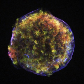
Young supernova remnants offer a unique observational lab to study how supernovae explosions work. When a star goes supernova, it sends a shock wave into the surrounding interstellar medium. Particles accelerated at the shock can reach 10s to 100s of TeV (CERN is at several TeV) and emit copious synchrotron radiation, which we see in radio and X-ray as bright nonthermal rims around the supernova's remnant.
Building on the work of Sean Ressler and others (arXiv:1406.3630), we measured the intensity profiles of synchrotron filaments in Tycho's supernova remnant, in archival Chandra and VLA data, to constrain magnetic field amplification and particle diffusion in the forward shock's wake. My contribution was advised by Rob Petre and Brian J. Williams at NASA Goddard. A writeup of our work is at arXiv:1509.00877 or at ApJ (paywalled).
Mud volcanoes
My undergraduate research, with Michael Manga and Max Rudolph at UC Berkeley, focused on bubble and particle motion in natural mud from mud volcanoes near the Salton Sea in Imperial Valley, CA. We measured bubble ascent times and, in conjunction with other published data, found an empirical drag scaling for bubbles in muds and non-Newtonian fluids with similar properties. A writeup of our work is available here.
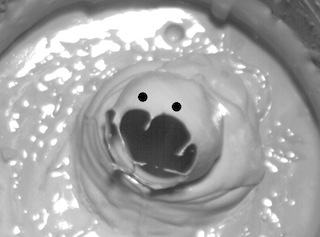
In the same lab I also assisted with some instrumentation (temperature, photodiode sensors) on a nifty model geyser that shows behavior comparable to that of natural geysers: preplay, and both major and minor eruptions. Although I am not in the vanguard of this work, you may find this press release interesting.
Some bubbles have personalities of their own – particularly when they refuse to rise on timescales of ~101 seconds.
Suburban land cover
In high school, I dabbled with some high spatial resolution Earth imagery under the guidance of Jindong Wu (California State University, Fullerton). We performed multispectral classification of visible and near infrared ASTER imagery of Fullerton, a typical suburban city ~25 minutes from downtown Los Angeles. (Sub)urban areas are hard to classify because of the heterogeneity of reflectance types; street asphalt has quite a variety of colors, for example. Classification allows us to understand how we use our land, estimate carbon storage in vegetation, and do other cool stuff. We also attempted shadow classification with higher resolution QuickBird imagery.
Some results of our work were presented at the 2010 AGU Fall Meeting by Prof. Wu; abstract here. He also wrote an article for the CSU Geospatial Review about the main project (2011 issue here).
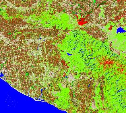
Below is an unsupervised classification image of most of Orange County, California, a little offshoot of our work. Salient features include the vegetation of Chino Hills and the northern Santa Ana Mountains; wetlands (red) of the Santa Ana River, behind Prado Dam in Corona; major freeways such as the 60, 5, 55, and 91; and Lake Mathews in Riverside County. Note the misclassification of shadowed valleys as water in the Santa Ana Mountains.